

Super Typhoon Inday Enters PAR, Signal No. 1 Up In Some Areas
“Inday will maintain its strength as a super typhoon until tomorrow (July 9),” the state weather bureau said.
Super Typhoon Inday (international name Bavi) entered the Philippine area of responsibility at 3 a.m. this morning, July 8, and as of 4 a.m., its center was estimated at 1,405 kilometers east of northern Luzon with a maximum sustained winds of 185 km per hour and gustiness of up to 230 kph, according to the Philippine Atmospheric, Geophysical and Astronomical Services Administration.
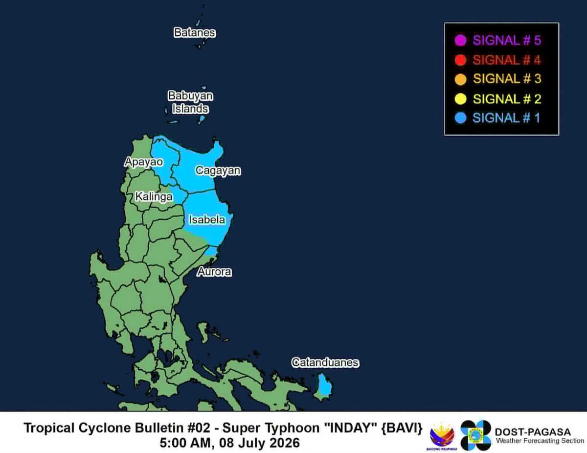
Tropical Cyclone Wind Signal No. 1 was raised over some areas in Luzon due to Inday. These include Batanes, Cagayan including Babuyan Islands, the northern and central portions of Isabela (Santo Tomas, Aurora, Santa Maria, Quezon, San Mariano, Naguilian, Dinapigue, Roxas, Luna, Delfin Albano, City of Cauayan, San Pablo, Ilagan City, Benito Soliven, Tumauini, Cabagan, Reina Mercedes, San Manuel, Palanan, Cabatuan, Quirino, Divilacan, Gamu, Mallig, Maconacon, Burgos, San Guillermo, Angadanan, Alicia, San Mateo), Apayao, the eastern portion of Kalinga (Pinukpuk, City of Tabuk, Rizal), the northern portion of Aurora (Dilasag), and the northern and central portions of Catanduanes (Pandan, Caramoran, Bagamanoc, Panganiban, Viga, Gigmoto, Baras, San Miguel).
Moderate to heavy rainfall is expected in some areas until Friday, July 10, because of Inday and the southwest monsoon.
The enhanced southwest monsoon and the periphery of Inday will bring strong to gale-force gusts over the following areas (especially in coastal and upland areas exposed to winds):
- Today: Pangasinan, Zambales, Bataan, Calabarzon, most of Mimaropa, Bicol region, most of Visayas, and most of Mindanao.
- Tomorrow, July 9: Most of the country
- Friday, Most of the country
A gale warning will be issued today over the northern and eastern seaboards of Luzon and Visayas, PAGASA said.
“It must be emphasized that heavy rainfall and severe winds may still be experienced in localities outside the landfall point and the forecast confidence cone,” the state weather bureau noted.
PAGASA said Inday “is forecast to move generally westward over the next 24 hours.”
“It will then turn northwestward while remaining over the Philippine Sea and may be nearest to extreme northern Luzon by Friday…before heading towards the southern islands of Japan and the sea north of Taiwan. Inday is forecast to exit the PAR by Saturday (July 11) and make landfall over the eastern coast of mainland China by Sunday (July 12),” PAGASA reported.
“Inday will maintain its strength as a super typhoon until tomorrow…and will downgrade into a typhoon by tomorrow afternoon or evening. Afterwards, it will gradually weaken. Nevertheless, it will likely remain a typhoon throughout the remaining forecast period,” it said.
The Philippine Coast Guard is on heightened alert, in preparation for Inday’s possible impact.
Interior Secretary Jonvic Remulla has ordered local chief executives to implement critical preparedness measures ahead of Inday’s entry. — With Evelyn Macairan, Emmanuel Tupas