


Just How Deadly Is Taal Volcano? Historical Records Describe Its Destructive Past
When Talisay Vice Mayor Charlie Natanauan Sr. said science cannot predict an impending disaster, maybe he can learn something from history.
When Talisay Vice Mayor Charlie Natanauan Sr. downplayed the imminent threat of a Taal Volcano eruption by saying scientists are not “God” to predict a disaster, it became apparent that much still needs to be done to inform the public about the dangers of the killer volcano.
Lamenting the negative impact on Talisay’s economy of the government’s response to the volcano’s recent activity, Natanauan downplayed the possible eruption by saying the lake would dissipate the lava from the volcano anyway, and business establishments and houses would be spared.
Phivolcs had said that the lull in volcanic activity indicated the rise of magma leading to an eruption.
So when the vice mayor said science cannot predict an impending disaster, maybe he can learn something from history.

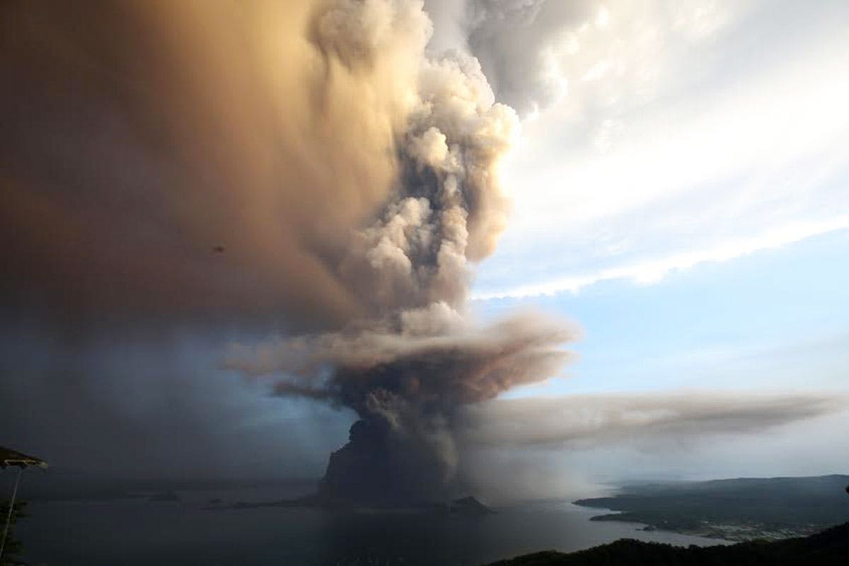
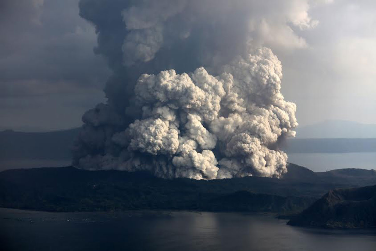
Accounts of the 1754 and 1911 volcanic eruptions present a dire picture of Taal’s fury, describing “balls of fire,” “electrical display,” deadly “sand blasts” and sounds of “heavy artillery fire.”
The 1754 eruption is the worst-case scenario being presented by Phivolcs in Taal’s current unrest.
“But right now, we still don’t know what it’s going to do. That is what’s mysterious about volcanoes,” Phivolcs chief science research specialist Mylene Villegas said in a press briefing last week.
Taal’s fury has been recorded by parish priests assigned in the area during the 1754 base surge, and American officials who responded to the 1911 eruption.
Dean Worcester, the interior secretary during the American occupation in the Philippines, wrote a comprehensive article titled “Taal Volcano and Its Recent Destructive Eruption” for the April 1912 issue of the National Geographic magazine.
Worcester, who also took photos of indigenous Philippine groups during the American colonial rule, was witness to the changing topography of the volcano.
He visited the Philippines and toured the islands in 1888 (when the country was still under Spanish rule), until 1911 when the volcano erupted during his term as interior secretary. He was among those who saw the photo of the summit of the volcano island before and after the 1911 eruption.
1911 eruption: ‘Artillery in action’
Worcester wrote an account of his 1888 expedition to the Philippines, during which he climbed Taal Volcano, in his earlier work titled “The Philippine Islands and Their People” published in 1898.
He saw an entirely different crater on top of the volcano island. It was not a single crater as it is now, but was composed of “three lakelets” of strange-colored water within a large crater.
“One was dirty brown, one intensely yellow, and one a most brilliant emerald green. The yellow and green lakelets were boiling away steadily, with a sullen roar, while our ears were assailed by a pandemonium of other sounds, the sources of which we could not make out with certainty. The scarred and blackened walls, with their hissing sulphur jets, the boiling lakes with their strange (colors), and the immense column of (vapor) combined to make a most extraordinary scene, grand in the extreme, and wholly beyond my powers of description,” Worcester wrote in his account.
The January 1911 eruption destroyed the crater walls, fusing the three into a single “great crater” from which protruded an “obelisk,” Worcester wrote, showing two photos of the crater before and after the eruption.


Worcester, as interior secretary, was also privy to the government response to and observations of the 1911 eruption, which he reported to have killed around 1,300 people.
Just 60 kilometers away from Taal Volcano, Manila was not spared from the eruption, having felt 88 earthquakes, 10 of which were more severe in Batangas province, Worcester wrote.
In describing the “area of devastation,” Worcester noted that seismic disturbances were felt within a 200-mile diameter. From Jan. 27 to Feb. 7, 1911, the capital Manila felt 472 earthquakes of Intensity 1, 97 of Intensity 2, 76 of Intensity 3 and 62 Intensity 4, or a total of 995 temblors.
American colonial government photographer Charles Martin took the photos published in the National Geographic showing the horrific display of power of the killer volcano.
Worcester described the situation according to an account from Martin:
“At 1:05 on the following morning, he (Martin) was awakened by an extraordinary explosion and saw an enormous column of mud rising from the crater… There was a magnificent display of ‘chain’ lighting about the black mud cloud, and the explosion had awakened and terrified every one. Twelve minutes later, there was a rain of mud at Tanauan. It was followed by a fall of fine, dry, volcanic ejecta. Shortly before 2 o’clock the sky, which had been obscured by the black mud cloud, cleared completely…
“(There occurred at 2:20 two terrific explosions… We now know that this explosion tore most of the floor out of the main crater of Taal Volcano and hurled it skyward. A huge black cloud continued to rise for a long time. Its ejection was attended by a most extraordinary electrical display, which was visible for 250 miles. The explosion was heard over an area more than 600 miles in diameter,” Worcester said. (Manila is only around 37 miles or 60 kms from Taal Volcano).
Worcester wrote that a “wonderful electrical display” was seen as far away as Manila, where “the shock of the explosion was so great that people leaped from beds in terror, thinking that there had been some great catastrophe in the city.”
There were also “‘globes of fire… that rose and fell in graceful curves” apart from the electrical display, Worcester said.
Worcester cited the account of a priest he identified as Jose Algue, then the director of the Manila Observatory, about the electrical display as seen from the capital city:
“The electrical display which accompanied the eruption added greatly to the terrors of the phenomenon. As seen from Manila, at a distance of 63 kilometers from the volcano, it had the appearance of an unusually violent (thunderstorm), except that there were no clouds, the brightest stars being visible through rifts in the huge masses of smoke, ashes, and mud,” Worcester’s article read, citing Algue.
Worcester also cited the disturbing account of then Batangas provincial treasurer George Muni, who recalled seeing “balls of fire” shooting from the crater.
“Suddenly, shortly after 1:00 a.m., we saw flashes of light, felt a severe shock, and heard a loud rumble. Then a thick, black, balloon-shaped cloud arose from the crater and hung over it, and was illuminated by sharp flashes and streaks of lightning… The earthquakes from then on seemed to be more violent, until, at about 2:20 a.m., a great explosion occurred, and we saw balls of fire shoot up above the crater, and an immense column of smoke ashes arose and formed a great cloud, which appeared to be several miles in height. This was lighted by a very vivid electrical display and accompanied by long, heavy rumblings, all of which lasted about 15 or 20 minutes,” Worcester quoted Muni as saying.
Worcester described the casualties as being “burned by acids,” “scalded by hot mud,” while the injured were “lacerated and their bones were fractured by stones from the volcano, falling timbers of houses, or flying debris driven by the dreadful blast from the crater.”
He expressed belief that a “gigantic sand blast,” as indicated by the fact that tree trunks were skinned, not burned, caused the deaths of many and destroyed crops on the island.
To illustrate how a volcanic blast can become deadly, Worcester gave this account by Private William Couch, a member of the Company “E” 2D Battalion, who was stationed in Bayuyungan (now the municipality of Laurel in Batangas) during the 1911 eruption:
“About 1 a.m., January 30, I was awakened by a loud rumbling noise. I got up and stepped outside of the tent. Looking across the lake in the vicinity of the volcano I saw great volumes of black smoke pouring out of the crater, accompanied by heavy explosions, resembling heavy artillery in action, and electrical display,” Couch said in his account cited by Worcester.
“The rumbling noise grew louder and louder and then a heavy report. I then saw the mud issuing from the crater as a cloud. In a few seconds I saw this cloud drifting across the lake toward our camp. Our camp was then swept by a heavy wind which broke the tent ropes and threw the tent into the air. This atmospheric disturbance threw me a distance of about 15 feet,” Couch added.
(This tends to counter the idea of Natanauan that the lake could dissipate the volcanic flow. Phivolcs also discounted the idea by saying Taal is capable of emitting a “base surge,” or a lateral or sideways explosion of steam and gas that could sweep over the water.)
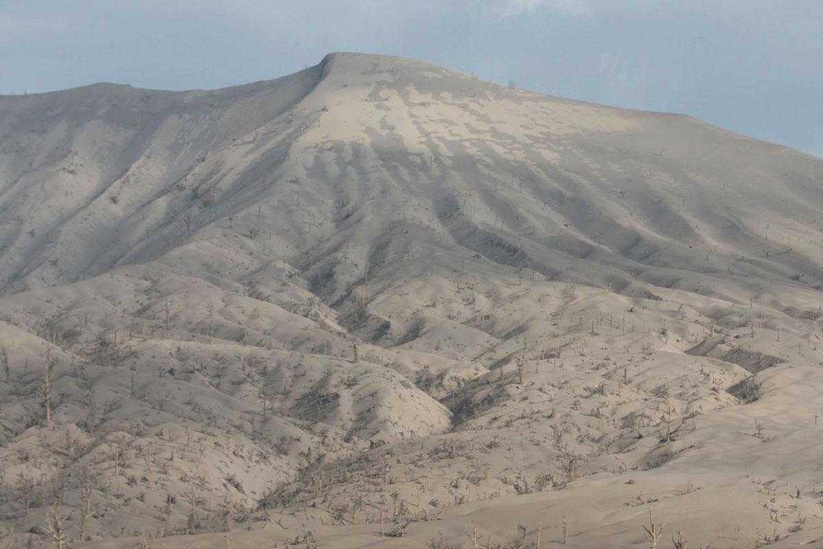
Couch also described a “tidal wave” from the lake that washed away their camp. Worcester estimated that the 1911 Taal eruption spread mud and volcanic ash in an area spanning 1,200 square miles.
Worcester said suffocation from the ash and sulphur was an “important cause of death.” In summarizing the general situation, Worcester wrote:
“There is no doubt that an immense body of steam and gases, heavily charged with fine volcanic ejecta, swept downward and outward in all directions from the crater rim. It stripped Volcano Island bare of all vegetation; caused a huge wave to extend outward over the surface of the lake; blew houses to bits; broke off many great forest trees; bent saplings, bushes, bamboo, and tall grasses to the ground on the mainland; and dealt instant death to every living creature fully exposed to its fury.”
Worcester said the 1911 explosion killed thousands because of the thick settlement that developed on and around the volcanic island.


1754 explosion: ‘A living picture of Sodom’
The 1754 eruption, according to Spanish records that were also cited by Worcester, lasted from May to November that year.
A historical account of a Spanish friar identified only as Father Buencuchillo was also cited by Worcester in his 1912 article.
Buencuchillo witnessed the 1749 and 1754 eruptions from the main crater, both of which were described by Phivolcs as a “very violent” phreatomagmatic eruption or a blast driven by both magma and steam.
The friar said he initially mistook the Aug. 11, 1749 eruption for the sound of “heavy artillery fire” usually heard from ships from Mexico entering the Balayan Bay to salute the image of Our Lady of Caysasay.
“I found it strange, however, when I found that the number of detonations already exceeded one hundred, and still they did not cease. This caused me to rise with some anxiety as to what could be the matter; but my doubts were quickly dispelled, as at this moment there appeared four excited natives who shouted: ‘Father, let us leave this place! The volcano has burst out and all this noise and racket comes from it!’ ” Buencuchillo wrote.
The parish priest then described seeing smoke from the island crater, and “enormous columns of sand ashes” rising from the lake in the shape of “pyramids” that “fell back into the lake like illuminated fountains.”
But these “pyramids of ash” proved to be deadly as they reached the lake shores where a tract of land “sank into the lake” after a strong quake, the friar narrated. This eruption displaced the residents of Sala and Tanauan, Buencuchillo recounted.
The same priest also witnessed the deadlier May 15, 1754 eruption that lasted up to November.
Buencuchillo described the 1754 eruption like a scene from a Biblical apocalypse: emitting from the crater were “sky-high, formidable flames intermixed with glowing rocks” which, upon falling back on the island and rolling down the mountain slopes, “created the impression of a large river of fire.”
Two weeks later or on June, 2, 1754, Buencuchillo wrote that the volcano started emitting “falling ejecta” that made the island “appear to be on fire.” The volcano island “never ceased to eject fire” from June 2 to Sept. 25, 1754, the priest wrote, describing the blackness caused by the mud flow as having “such bad character that the best ink does not cause so black a stain.”
On Sept. 25, Buencuchillo said the volcano emitted “fire” accompanied by “terrifying rumblings.” He found it “strange” that thunderstorms accompanied the “black column of smoke” since the June eruption, and that the “huge tempest would scarcely ever disappear during two months.”
The volcano became quiet from Sept. 26 but rumbled a month later or on Nov. 1, 1754, “ejecting fire, rocks, sand, and mud in greater quantities than ever before,” Buencuchillo added.
On Nov. 15, 1754, the volcano “vomited enormous boulders” that rolled down the mountain slopes and caused “huge waves” from the lake, he wrote.
Buencuchillo remembered the eruption on Nov. 28, 1754 as a “living picture of Sodom,” during which the volcano emitted such an enormous amount of “fire and ejecta” in a single day that was greater than those emitted in the past months.
“The columns of fire and smoke ascended higher than ever before, increasing every moment in volume and setting fire to the whole island, there being not the smallest portion of the latter which was not covered by the smoke and the glowing rocks and ashes. All this was accompanied by terrific lightning and thunder above and violent shocks of earthquakes underneath,” Buencuchillo wrote, as cited by Worcester.
“We left the town, fleeing from this living picture of Sodom. With incessant fear lest the raging waters of the lake overtake us, which were at the moment invading the main part of the town, sweeping away everything which they encountered,” he said.
In the afternoon of Nov. 29, 1754, it began to rain ashes and mud that lasted three days and caused the sky to be shrouded in such darkness, he wrote, that “we could not have seen the hand placed before the face had it not been for the sinister glare of the incessant lightnings.”
“All was horror during those three days, which appeared rather like murky nights, and we did not occupy ourselves with anything but see to it that the natives swept off the roofs the large quantities of ashes and stones which kept on accumulating upon them and threatened to bring them down upon us, burying us alive beneath their weight,” Buencuchillo stressed.
On Dec. 3 and 4, 1754, the volcano simmered down, but a typhoon ravaged the province, the priest wrote. Twelve people died in the eruption, according to the priest’s account, although the number was questioned by Phivolcs in its historical timeline of Taal eruptions.
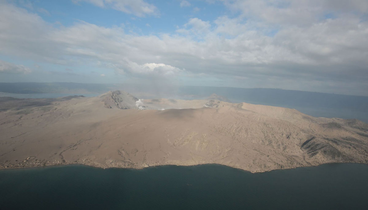
The 1754 eruption greatly altered the topography of Taal Volcano and the lake. The earthquakes and the release of ash and rocks from the volcano were so intense the mouth of the Pansipit River was blocked, cutting off Taal Lake from Balayan Bay and thus transforming the once salty lake into a body of fresh water.
Besides decimating the island town of Taal, the eruption and the swollen lake also caused the inundation of the old towns of Lipa, Tanauan and Sala, forcing the residents to move to other settlements.
Taal now: An imminent eruption?
According to Phivolcs, Taal’s last activity was on Oct. 3, 1977, which was only a phreatic or steam-driven explosion.
The last deadly eruption occurred on Sept. 28 to 30, 1965, but the phreatomagmatic or magma and water-driven explosion occurred in Mt. Tabaro, not the crater. It claimed 200 lives.
With Phivolcs warning that the main crater now appears to be “regenerating” for another major eruption, will history repeat itself?
As Worcester wrote in concluding his 1912 article:
“Today, Taal Volcano slumbers peacefully. The great gap recently torn in its crater floor is filled by the shimmering waters of a placid lake, from which there hardly rises so much as a whiff of steam; but somewhere below that smiling surface titanic energies are again slowly but surely gathering. Sooner or later, they will once more rend the solid earth asunder in an explosion which will blow rocks and earth to powder and drive that powder in a death-dealing blast across the neighboring country. What precautions should be taken to prevent future great loss of life?”
History has lessons to impart in dealing with cataclysmic disasters.


