



Super Typhoon Rosal Accelerates, Signal No. 1 Up In Some Areas, Heavy Rainfall Warning Issued
“Further intensification remains possible within the next (six) hours as (Super Typhoon) Rosal moves over the Philippine Sea before a weakening trend begins,” the state weather bureau said.
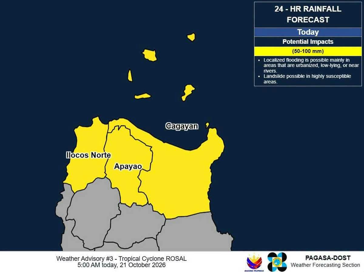
Super Typhoon Rosal accelerated while over the sea east of Northern Luzon based on the Philippine Atmospheric, Geophysical, and Astronomical Services Administration’s 5 a.m. advisory today, Oct. 21.
Rosal, with the international name Champi, entered the Philippine area of responsibility (PAR) at at 10:40 a.m. on Tuesday, Oct. 20.
As of 4 a.m. today, PAGASA said the center of Rosal was at 990 kilometers east of Northern Luzon with a maximum sustained winds of 215 kilometers per hour near the center and gustiness of up to 265 km per hour.
Tropical Cyclone Wind Signal No. 1 was hoisted over these areas in Luzon: Batanes, Babuyan Islands, the northern portion of Ilocos Norte (Pagudpud), the northern and eastern portions of mainland Cagayan (Santa Ana, Gonzaga, Lal-Lo, Santa Teresita, Camalaniugan, Aparri, Buguey, Gattaran, Baggao, Peñablanca, Santa Praxedes, Claveria, Sanchez-Mira, Pamplona, Ballesteros, Abulug, Allacapan), the northeastern portion of Isabela (Maconacon, Divilacan, Palanan), and the northeastern portion of Catanduanes (Pandan, Bagamanoc, Panganiban, Viga, Gigmoto).
“The highest wind signal that may be raised during the passage of Rosal is Wind Signal No. 2 Or 3,” the state weather bureau said.
Heavy rainfall outlook was also issued due to Rosal. The areas affected today are: Ilocos Norte, Apayao, and Cagayan (50 to 100 millimeters); Tomorrow (Oct. 22) – Batanes (100 to 200 mm), Ilocos Norte, Apayao, and Cagayan (50-100 mm); Friday (Oct. 23) – Batanes (50-100 mm).
PAGASA said the northeasterly windflow and the periphery of Rosal will bring strong to gale-force gusts over the following areas (especially in coastal and upland areas exposed to winds):
- Today: Ilocos Region, Cordillera Administrative Region, Cagayan Valley, Bicol Region, Romblon, Eastern Visayas, Siquijor, Bohol, Northern Mindanao, Caraga, Davao Region, and Sarangani.
- Tomorrow: Most of Luzon and Visayas, Zamboanga del Norte, Northern Mindanao, Agusan del Norte, Surigao del Norte, Dinagat Islands, Sarangani, Davao Occidental, and Davao Oriental.
- Friday: Most of Luzon and Visayas, Camiguin, Misamis Occidental, Lanao del Norte, Dinagat Islands, Davao Occidental, and Davao Oriental.
A gale warning is in effect over the northern and eastern seaboards of Luzon and the eastern seaboard of Visayas.
“Rosal will continue moving west northwestward today, then northwestward until Friday morning, before recurving northeastward by Sunday (Oct.25). On the forecast track, the tropical cyclone will be closest to extreme Northern Luzon between tomorrow and Friday afternoon. It will exit the (PAR) by Friday evening or Saturday (Oct. 24) early morning,” PAGASA said.
“Further intensification remains possible within the next (six) hours as Rosal moves over the Philippine Sea before a weakening trend begins. It is forecast to weaken into a typhoon tomorrow and into a severe tropical storm by Sunday,” it added.
The Philippine Coast Guard (PCG) raised the alert status particularly in areas that might be affected by Rosal.
In an interview over Radyo Pilipinas on Tuesday morning, PCG spokesperson Commodore Noemie Cayabyab said their deployable response group, composed of rescue swimmers and medical team, have been activated and placed on alert 24/7 in areas that might be affected by bad weather.
Cayabyab said they have also activated their search and rescue units in and near these areas. — With Josiah Antonio Evelyn Macairan


